Map Projections
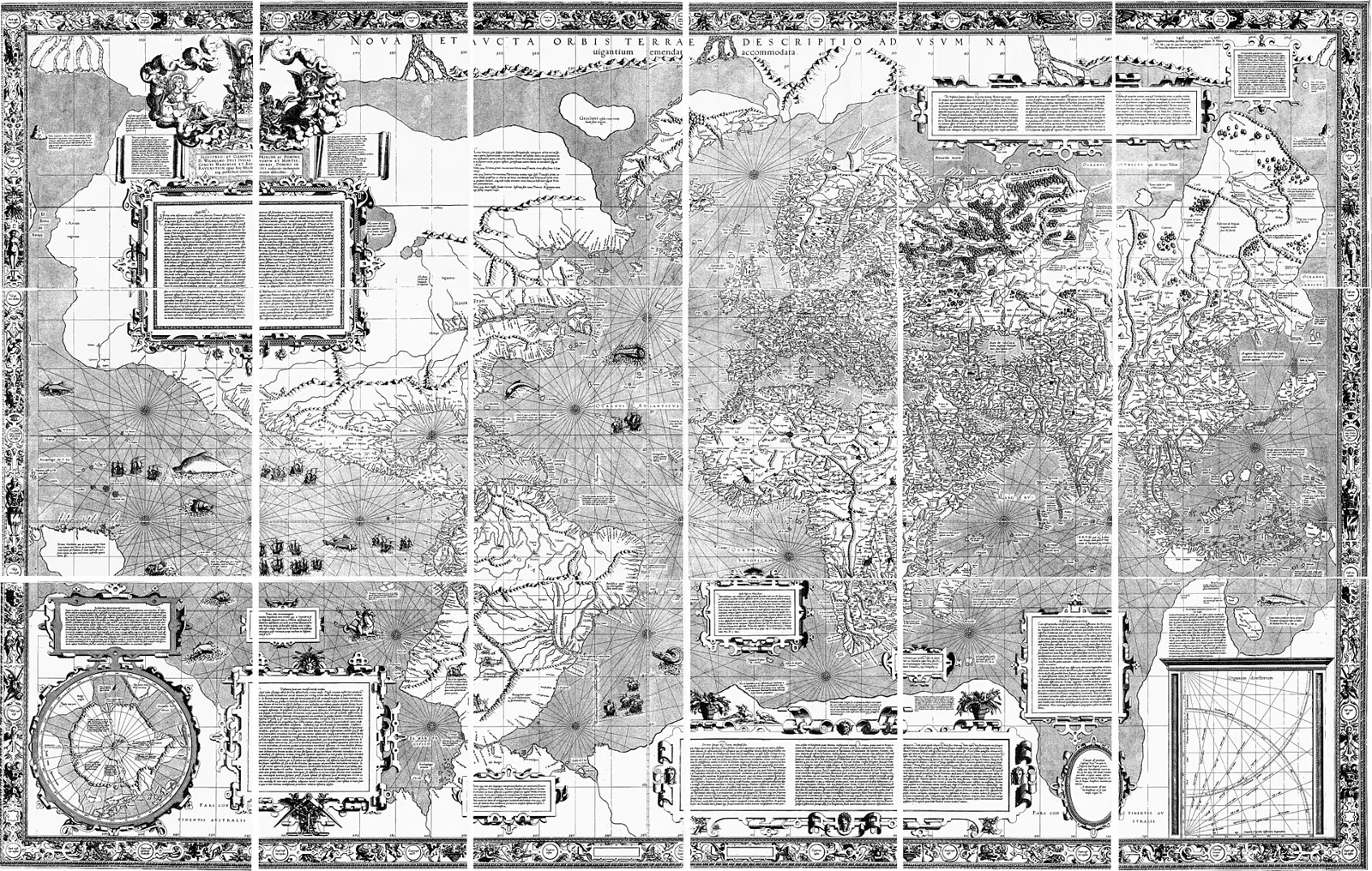
You can't flatten an orange peel without tearing or stretching it, and you can't flatten the Earth without distorting it. Every flat map gives up some of true shape, area, distance, and direction. Mercator's 1569 map keeps compass courses straight but blows up areas toward the poles, which is why Greenland looks as big as Africa (Africa is 14 times larger). The main families, what each keeps, and why a USGS topo map is nearly perfect anyway.
- 4 min
- 6 steps
- 2 questions
- Lesson 2 of 6
In this lesson
- What a map can’t do
- Mercator’s bargain
- Other ways to flatten
- Scale changes everything
- Try it
Picking up where you left off.
Peel an orange and try to press the peel flat. It tears or stretches. The Earth is the same problem: any way of putting the round globe on a flat page, a map projection, distorts something 1.
What a map can’t do
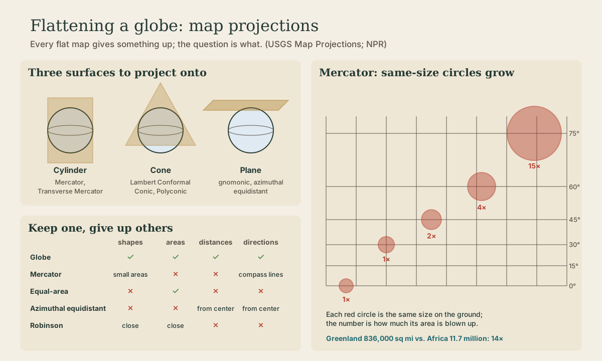
A globe shows four things correctly at once: shapes, areas, distances, and directions. A flat map can keep one or more of those, but never all four 1. There is no “best” projection, only the right one for a job, chosen to protect what matters most 1. Roughly:
- Conformal maps keep the shapes of small areas and the angles between directions, but sizes are wrong.
- Equal-area maps keep sizes in proportion, but shapes are distorted.
- Equidistant maps keep distances true only along certain lines, such as everything measured from the center point.
The flattening surface gives the families their names: wrap a cylinder around the globe (cylindrical), set a cone on it (conic), or touch it with a flat plane (azimuthal) 1.
Mercator’s bargain
Gerardus Mercator published his projection in 1569. Its one unique virtue: a straight line drawn anywhere on it is a rhumb line, a course of constant compass direction 1. A navigator could rule a line from port to port, measure its angle, and steer that heading. It is also conformal, so small areas have the right shape 1.
The price is size. To keep shapes right while making the meridians parallel, Mercator stretches everything north–south as much as east–west the farther it is from the equator. Distances and areas are reasonably true within about 15° of the equator and grossly distorted near the poles, which can’t be shown at all 1. At 60° latitude areas are drawn about four times too big.
The famous example: on a Mercator map Greenland (about 836,000 square miles) looks roughly as big as Africa, which is actually about 14 times larger 2. Canada, Scandinavia, and Russia all loom large. A version of Mercator still underlies online mapping tools such as Google Maps 2.

Quick check
Draw a line, read its angle, and steer that compass course; areas and distances are the price.
Other ways to flatten
- Gnomonic: projected from Earth’s center onto a plane, so any straight line on it is a great circle, the shortest route between two points. Navigators used it alongside Mercator to plan the shortest path. It may be the oldest projection, credited to Thales in the 500s BCE 1.
- Azimuthal equidistant: distances and directions are true from the center point to anywhere else. Handy for airline and radio distances; the polar version is on the United Nations emblem 1.
- Robinson (1963): a compromise designed to make the world “look right,” balancing size and shape at high latitudes without getting either exactly. National Geographic adopted it in 1988 1.
- Equal Earth: a newer equal-area world map; in 2025 the African Union backed using it instead of Mercator so Africa appears at its true relative size 2.
Scale changes everything
Distortion depends on how much of the globe a map shows. The “almost grotesque” stretching of a world Mercator map nearly vanishes on a large-scale map of a small area, and a USGS 1:24,000 topographic quadrangle is “nearly correct in every respect” 1. USGS drew its quadrangles on the Polyconic projection until the late 1950s, then switched mostly to the Lambert Conformal Conic and the Transverse Mercator, the projections behind the State Plane Coordinate System 3. For a county map or a hunting-land plat, the projection hardly matters; for a world map, it decides what you see.
Playback is optional. If the player is unavailable, open the video at its source.
Quick check
Distortion grows with the size of the area shown; a quadrangle is only about 50 to 60 square miles.
Try it
Search for “true size of” map tools online and drag Greenland down to the equator, or drag Wisconsin up to the Arctic and watch it swell. Then compare Greenland and Africa on a globe, if you have one.
Lesson complete
Nice work.
Sources for this lesson
- 1Map Projections (General Interest Publication poster). U.S. Geological Survey. verifiedNo flat map can show all of true directions, distances, areas, and shapes; no best projection. Mercator (1569): any straight line is a rhumb line of constant direction; conformal for small areas; areas and distances grossly distorted toward the poles; reasonably correct within 15 degrees of the equator. Equal-area maps distort shapes; conformal maps distort areas; equidistant maps true only along lines from the center. Gnomonic: straight lines are great circles; ascribed to Thales. Azimuthal equidistant: true distances from the center; UN emblem. Robinson (1963): balances size and shape, adopted by National Geographic in 1988. A 1:24,000 7.5-minute topographic map on the Transverse Mercator is nearly correct in every respect. On a globe, meridians at 60 degrees are half as far apart as parallels.
- 2Is Greenland really as big as it looks on a map?. NPR. 2026. verifiedGreenland covers more than 836,000 square miles; on a Mercator map it looks about the size of Africa, which is about 14 times larger. Mercator makes parallels and meridians straight lines so a course is a straight line; a version is used by online mapping tools such as Google Maps. The African Union backed replacing Mercator with the Equal Earth map.
- 3John P. Snyder. Map Projections Used for Large-Scale Quadrangles by the U.S. Geological Survey (Circular 982). U.S. Geological Survey. 1986. verifiedUntil the late 1950s USGS used only the Polyconic projection for its quadrangles; then mostly Lambert Conformal Conic or Transverse Mercator, as used for the State Plane Coordinate System; later UTM.