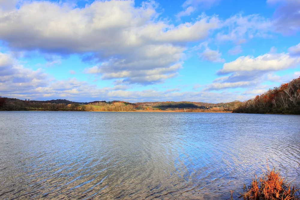
Why Are There So Many Lakes Around Here?
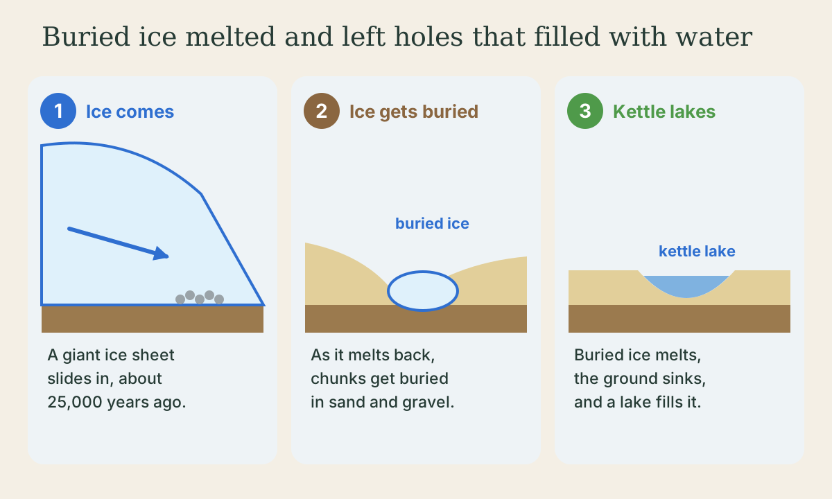
Because a giant sheet of ice covered most of Wisconsin during the last Ice Age. Around here, the ice arrived about 25,000 years ago and started melting back about 15,000 years ago. As it melted, it left big chunks of ice buried in sand and gravel. When those melted too, the ground sank into bowl-shaped holes called kettles, and they filled with water. Madison's big lakes are a little different: they fill the low spots of a deep old river valley the glacier didn't fill up. Wisconsin has about 15,000 lakes, but the corner the glacier never reached, the Driftless Area, has almost no natural lakes at all.
- 4 min
- 7 steps
- 3 questions
- Lesson 105 of 157
In this lesson
- The short answer
- The giant ice
- Kettle lakes
- Madison’s big lakes
- The place the ice missed
- So many lakes
- So
Picking up where you left off.
The short answer
Most of the lakes around here were made by ice. During the last Ice Age, a giant sheet of ice slid down over most of Wisconsin. When it melted, it left behind holes and dams that filled up with water 1 2.
The giant ice
Imagine ice so thick it would bury your house, your school, and the tallest building downtown. In the middle, the ice sheet was thousands of feet thick. At its edge it was a steep slope of ice, maybe several hundred feet high 1. Scientists call this time the Wisconsin Glaciation, named after our state 1.
Around Madison and Stoughton, the ice arrived about 25,000 years ago and pushed as far as it would go about 20,000 years ago. It started melting back about 15,000 years ago 2. While it was here, woolly mammoths walked on the cold, treeless land in front of it 1.
Quick check
The ice left behind holes and dams that filled with water.
Kettle lakes
As the ice melted back, big chunks broke off and got buried in the sand, gravel, and mud the glacier was dropping. Buried ice melts very slowly. When those chunks finally melted, the ground on top sank into bowl-shaped holes, some 10 to 50 feet deep. Scientists call them kettles, and many filled with water to become lakes and ponds 2.
Fish Lake, Crystal Lake, and Indian Lake, all near Madison, sit in kettles 2.

Quick check
Indian Lake, near Madison, is one.
Madison’s big lakes
Lake Mendota, Lake Monona, Lake Waubesa, and Lake Kegonsa, the lakes along the Yahara River near Stoughton, are a little different. Before the Ice Age, a river had carved a very deep valley here. The glacier filled most of it with more than 300 feet of sand and gravel, but not all of it. The lakes sit in the low spots that never got filled up 2. Long ago, when the ice was melting, one big lake called Glacial Lake Yahara covered them all, and the hill where the State Capitol stands was an island 2.
The place the ice missed
Drive west toward the Mississippi and the land changes: steep hills, deep valleys, and winding streams. That’s the Driftless Area. “Drift” is what geologists call the sand and rocks a glacier leaves behind, and this area doesn’t have any, because the ice sheet never covered it 3. With no buried ice chunks and no glacier dams, and with streams wearing away any natural dams over a very long time, it has almost no natural lakes 2.
Quick check
Without the glacier, there were no buried ice chunks and no glacier dams.
So many lakes
Wisconsin has about 15,000 lakes 4. The glacier made our state one of the thickest clusters of lakes anywhere in the world. Most of them are up north, where the ice left even more holes and dams 5.
Playback is optional. If the player is unavailable, open the video at its source.
So
There are so many lakes around here because a giant sheet of ice covered this land in the last Ice Age. When it melted, buried chunks of ice left holes called kettles that filled with water, and the ice left a deep old valley only partly filled, where Madison’s big lakes are now. The corner of Wisconsin the glacier missed has almost no natural lakes at all.
Lesson complete
Nice work.
Sources for this lesson
- 1Ice Age Geology. Wisconsin Geological and Natural History Survey. verifiedThe last glacier began advancing into Wisconsin about 31,500 years ago and expanded for 13,500 years; warming began about 18,000 years ago and the ice took another 7,000 years to leave northern Wisconsin, about 11,000 years ago; lobes: Lake Michigan, Green Bay, Langlade, Wisconsin Valley, Chippewa, Superior; the outermost limit is marked by a conspicuous ridge of glacial debris, and the many lakes and wetlands and irregular landscape of eastern and northern Wisconsin come from the last glacier.
- 2David M. Mickelson. Landscapes of Dane County, Wisconsin (Educational Series 43). Wisconsin Geological and Natural History Survey. 2007. verifiedIce arrived about 25,000 years ago and reached its farthest point in Dane County about 20,000 years ago (the Johnstown moraine); it began melting back about 15,000 years ago and was shrinking rapidly by 13,000. Moraines are pockmarked with kettle holes, 10 to 50 feet deep, formed when isolated ice masses buried in sediment melted; Fish, Crystal, and Indian Lake (Indian Lake County Park) are kettles. Madison's Yahara lakes fill low, unfilled parts of a deep preglacial valley; Glacial Lake Yahara once covered them. No natural lakes lie in the Driftless Area of Dane County, because long stream erosion removed natural dams.
- 3Eric C. Carson, et al.. The Driftless Area (Educational Series 57). Wisconsin Geological and Natural History Survey. 2023. verifiedThe Driftless Area is named for its lack of drift, glacial sediment; after more than 150 years of study, all evidence supports that it was never covered by an ice sheet, and it was never entirely surrounded by ice at one time.
- 4
- 5Herbert S. Garn, John F. Elder, Dale M. Robertson. Wisconsin Lakes (Fact Sheet 063-03). U.S. Geological Survey. 2003. verifiedGlaciation ending about 10,000 years ago created one of the densest clusters of lakes found anywhere in the world; more than 80 percent of Wisconsin's lakes are in the Northern Lakes and Forests region.